INTRODUCTION
HISTORY
There is nothing much to talk about the history of Kudremukh other than the fact that in 1916, the British Government declared Kudremukh as a Reserved Forest to stop deforestation. In 1987, the Government of Karnataka declared these Reserved Forests as a National Park.ORIENTATION
Kudremukh in Chikmagalur district of Karnataka overlooks the Arabian Sea and is surrounded by mountain ranges.BEST TIME TO VISIT
The ideal time to visit Kudremukh is between the months of December and February.FAIRS & FESTIVALS
KARAVALI FESTIVAL
Karavali Festival falls in the month of February. This festival organized by the Government of Karnataka is celebrated with great pomp in nearby Mangalore. The main highlights of this festival are the Demon Worship, Nagamandala and Demon Dance.NAVRATHIRI FESTIVAL
Navrathri festival falls in the month of December and is celebrated for ten-day festival in nearby Chikmagalur on the occasion of Durga PujaPLACES OF INTERESTS
LAKYA DAM
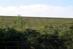
This dam was built by Kudremukh Iron Ore Company Ltd (KIOCL).
It is ideal for an evening walk across the dam.
KUDREMUKH PEAK
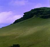
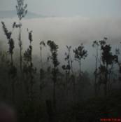
The hills are broad and connected to each other like a chain, with deep plains and valleys and are enchanting with natural splendour and beauty.
One can also spot lion tailed Macaques in this area.
St.CATHERIAN'S FALLS
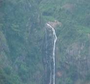
This double-cascaded Falls is the second highest in the district (250 ft) and it waters from the upper stream of the kallar river crossed by the invisible Mettupalyam-Ooty road beyond the mountains in the south-west.
From this point of view Dolphin's Nose of Coonoor is also seen across the mighty gap in the hills.
It presents a lovely view of the tea gardens and forests and woodlands
LONGWOOD SHOLA
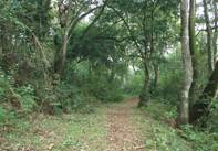
Longwood shola is one of the major water resources in Kotagiri for more than 15 villages in the Aravenu area.
In this area of the Western Ghats one can get to see the stunted evergreen vegetation or the shola forests and this plays a major role in Kotagiri's microclimate.
This is an ideal place for trekking and for bird watchers.
Longwood Shola is also noted for Indian giant squirrel, bonnet macaque, barking deer, Nilgiri Marten and Indian bison.
KUDREMUKH NATIONAL PARK
This is one of the recently declared National Park in Karnataka which extends over three districts, Dakshin Kannada (South Kanara), Chickmaglur and parts of Udupi and stretches between Narasimha Parvatha (in Sringeri Taluk) in the north to the Jamalabad Fort (in Belthangady Taluk) in the south.The park is also divided into four ranges Kudremukh, Kerekatte, Kalsa, and Shimoga.
The forest officials of this area have demarcated about 13 standard trekking routes.
HANUMAN GUNDI WATERFALLS
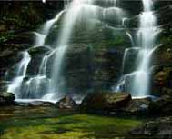
The waterfall looks very majestic and falls from height of about 100 feet with the slashing noise of the water.
You can trek to this place and make yourself refreshing by having a bath in this water.
.
GANGAMOOLA
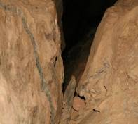
Gangamoola is amidst a dense forest and is noted for its picturesque location.
There is also a cave which houses a shrine of Goddess Bhagavathi and a Varaha image.
JAMALABAD FORT
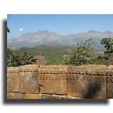
The fort was renamed after his mother Jamalbee.
The village which is located at the base of a high rock, comprises a part of the Kudremukh range of hills near Belthangadi.
HORANADU
Horanadu which is located at a distance of about 28kms from Kudremukh and 8 km from Silent Valley is known for its Annapoorneshwari Temple.There are two temples in close proximity namely the Kaleshwara Temple and the Girijamba Temple where the presiding deity of the former is Lord Shiva. There is a three day festival in the Girijamba Temple which celebrates the marriage between kaleshwara and Girijamba.KALASA
Amba Tirtha is quite famous for there is a Sanskrit inscription in this place which states that Sri Madhavacharya founder of the Dvaita School of philosophy brought and placed it here with one hand.
SHOPPINGThere is nothing much to shop here except for some fresh ground coffee.EAT OUTSBhagavathi Nature Camp has a captive kitchen to service their guests. The nearest place to find restaurants is in the town of Kalasa, where basic but clean South Indian food can be availed.ACCOMMODATION1.Silent Valley ResortThodlu, Kalasa-Kudremukh Road Chickmagalur district Kalasa - 577124 Phone +91 9008444436/38 +91 824 2211672 +91 8263 274801/02 2.Kudremukh Wildlife Division Seethanadi, Hebri Village Karkal Taluk, Udupi Karnataka - 576112 India 3.Chandan Hotel Mahaveera Road, Kalasa, Mudigere Taluk Chikmagalur Karnataka - 577124 India |
Travel Guide
Travel Information
| |||||||||||||||||||||||||||||||||||||||


